Monroe County (Iowa)
| County in de Verenigde Staten | |||
|---|---|---|---|
 | |||
| Situering | |||
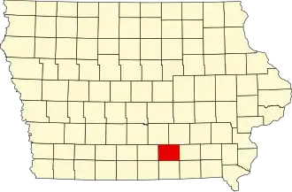
| Staat | Iowa | ||
| Coördinaten | 41°1'42"NB, 92°52'12"WL | ||
| Algemeen | |||
| Oppervlakte | 1.125 km² | ||
| - land | 1.123 km² | ||
| - water | 2 km² | ||
| Inwoners (2000) |
8.016 (7 inw./km²) | ||
| Overig | |||
| Zetel | Albia | ||
| FIPS-code | 19135 | ||
| Opgericht | 1843 | ||
| Website | monroecoia | ||
| Foto('s) | |||
 | |||
 Bevolkingspiramide Monroe County | |||
| Statistieken volkstelling Monroe County | |||
| |||
Monroe County is een county in de Amerikaanse staat Iowa.
De county heeft een landoppervlakte van 1.123 km² en telt 8.016 inwoners (volkstelling 2000). De hoofdplaats is Albia.
Bevolkingsontwikkeling
| Jaar | Inwoners | % ± | |
|---|---|---|---|
| 1900 | 17.985 | — | |
| 1910 | 25.429 | 41,4% | |
| 1920 | 23.467 | −7,7% | |
| 1930 | 15.010 | −36,0% | |
| 1940 | 14.553 | −3,0% | |
| 1950 | 11.814 | −18,8% | |
| 1960 | 10.463 | −11,4% | |
| 1970 | 9.357 | −10,6% | |
| 1980 | 9.209 | −1,6% | |
| 1990 | 8.114 | −11,9% | |
| 2000 | 8.016 | −1,2% | |
| Bron: (en) Historical Decennial Census Population | |||
Zie de categorie Monroe County, Iowa van Wikimedia Commons voor mediabestanden over dit onderwerp.