Tanahu (district)
| District in Nepal | |||
|---|---|---|---|
 | |||
 | |||
| Situering | |||
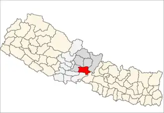
| Regio | Western (WDR) | ||
| Zone | Gandaki | ||
| Coördinaten | 27°55'NB, 84°15'OL | ||
| Algemeen | |||
| Oppervlakte | 1546 km² | ||
| Inwoners (2011) |
323.288[1] (209 inw./km²) | ||
| Hoofdstad | Byas | ||
| Overig | |||
| Website | Officiële website | ||
| Foto's | |||
 | |||
| |||
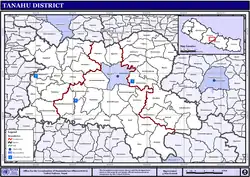
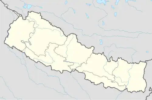
Tanahu (Nepalees: तनहू) is een van de 75 districten van Nepal. Het district is gelegen in de bestuurlijke zone Gandaki en de hoofdstad is Byas, vroeger Danauti genaamd.
- Stad: Nepalees: nagarpalika of N.P.; Engels: municipality;
- Dorpscommissie: Nepalees: panchayat; Engels: village development committee of VDC.
- Steden (1): Byas (vroeger: Danauti).
- Dorpscommissies (46): Anbukhaireni, Arunodaya, Baidi, Bandipur, Barbhanjyang, Basantapur, Bhanu, Bhanumati, Bhimad, Bhirkot, Chhang, Chhimkeswori (of: Chhimkeshwori), Chhipchhipe, Chok Chisapani, Deurali, Devghat, Dharampani, Dhorfirdi, Dulegaunda, Firfire, Gajarkot, Ghansikuwa, Jamune Bhanjyang, Kahu Shivapur, Keshavtar, Khairenitar, Kihun, Kota, Kotdarbar, Kyamin, Majhkot (of: Majhakot), Manpang, Mirlung, Pokhari Bhanjyang, Purkot, Raipur, Ramjakot, Ranipokhari(Reising) (of: Ranipokhari (Resing)), Risti, Rupakot, Satiswara, Shambu Bhagawatipur (of: Shamung Bhagawatipur), Shymgha, Sundhara (of: Sundhara (Ghiring)), Tanahunsur, Thaprek.
Bronnen, noten en/of referenties
- ↑ Census 2011: Final Results p. 65
- ↑ Min. Fed. Zaken en Lok. Ontwikk.: Lijst van steden (N.P.s) vanaf p. 2 en dorpscommissies (VDCs) p. 45.
- ↑ Min. Fed. Zaken en Lok. Ontwikk.: Wegenkaart en kaart van steden (N.P. of municipality) en dorpscommissies