La Chapelle-devant-Bruyères
| Gemeente in Frankrijk | |||
|---|---|---|---|
 | |||
 | |||
| Situering | |||
| Regio | Grand Est | ||
| Departement | Vosges (88) | ||
| Arrondissement | Saint-Dié-des-Vosges | ||
| Kanton | Gérardmer | ||
| Coördinaten | 48° 11′ NB, 6° 47′ OL | ||
| Algemeen | |||
| Oppervlakte | 20,23 km² | ||
| Inwoners (1 januari 2023) |
547[1] (27 inw./km²) | ||
| Hoogte | 447 - 768 m | ||
| Overig | |||
| Postcode | 95780 | ||
| INSEE-code | 88089 | ||
| Detailkaart | |||
 | |||
| Foto's | |||
_%C3%A9glise.jpg) | |||
| Kerk | |||
| |||
La Chapelle-devant-Bruyères is een gemeente in het Franse departement Vosges in de regio Grand Est. De gemeente telde 547 inwoners op 1 januari 2023.[1] Zij maakt deel uit van het arrondissement Saint-Dié-des-Vosges.
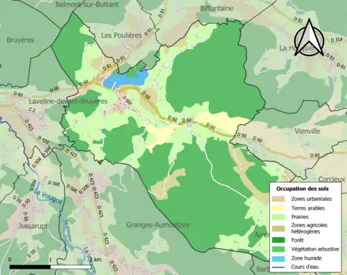
Geografie
De oppervlakte van La Chapelle-devant-Bruyères bedraagt 20,23 vierkante kilometer. De bevolkingsdichtheid op 1 januari 2023 was 27 inwoners per km².
Demografie
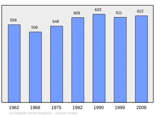
Onderstaande figuur toont het verloop van het inwonertal.[2]
Bronnen, noten en/of referenties
- 1 2 Populations de référence 2023.
- ↑ (fr) Statistische informatie op de website van het Franse bureau voor statistiek INSEE, cijfers inwoneraantal volgens de definitie "population sans doubles comptes"
Zie de categorie La Chapelle-devant-Bruyères van Wikimedia Commons voor mediabestanden over dit onderwerp.