Villeny
| Gemeente in Frankrijk | |||
|---|---|---|---|
 | |||
| Situering | |||
| Regio | Centre-Val de Loire | ||
| Departement | Loir-et-Cher (41) | ||
| Arrondissement | Romorantin-Lanthenay | ||
| Kanton | Chambord | ||
| Coördinaten | 47° 37′ NB, 1° 45′ OL | ||
| Algemeen | |||
| Oppervlakte | 33,98 km² | ||
| Inwoners (1 januari 2023) |
487[1] (14 inw./km²) | ||
| Hoogte | 93 - 136 m | ||
| Overig | |||
| Postcode | 41220 | ||
| INSEE-code | 41285 | ||
| Website | Officiële website | ||
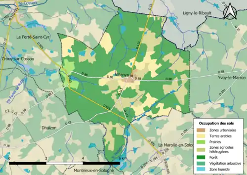
| Detailkaart | |||
 | |||
| Foto's | |||
 | |||
| Gemeentehuis en kerk | |||
| |||
Villeny is een gemeente in het Franse departement Loir-et-Cher (regio Centre-Val de Loire) en telt 337 inwoners (2004). De plaats maakt deel uit van het arrondissement Romorantin-Lanthenay.
Geografie
De oppervlakte van Villeny bedraagt 32,4 km², de bevolkingsdichtheid is 10,4 inwoners per km².
Demografie
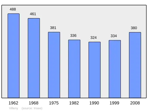
Onderstaande figuur toont het verloop van het inwonertal (bron: INSEE-tellingen).
Externe links
- (fr) Statistische informatie op de website van het Franse bureau voor statistiek INSEE
Zie de categorie Villeny van Wikimedia Commons voor mediabestanden over dit onderwerp.
- ↑ Populations de référence 2023.