Shire of West Arthur
| Local Government Area van Australië | |||
|---|---|---|---|
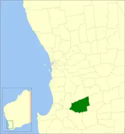 Locatie van Shire of West Arthur in West-Australië | |||
| Situering | |||
| Staat | West-Australië | ||
| Hoofdplaats | Darkan | ||
| Coördinaten | 33°20'17"ZB, 116°44'35"OL | ||
| Algemene informatie | |||
| Oppervlakte | 2.834,2 km² | ||
| Inwoners | 773 (2021)[1] | ||
| Overig | |||
| Wards | 4 | ||
| Website | (en) Shire of West Arthur | ||
| |||
Shire of West Arthur is een lokaal bestuursgebied (LGA) in de regio Wheatbelt in West-Australië. De hoofdplaats is Darkan.

Geschiedenis
Op 10 januari 1896 werd het West Arthur Road District opgericht. Ten gevolge van de Local Government Act van 1960 veranderde het district op 23 juni 1961 van naam en werd de Shire of West Arthur.[2]
Beschrijving
Shire of West Arthur is een landbouwdistrict in de regio Wheatbelt. Het is 2.834 km² groot en ligt ongeveer 200 kilometer ten zuidoosten van de West-Australische hoofdstad Perth. Het administratieve en dienstencentrum van het district is Darkan.
Tijdens de volkstelling van 2021 telde Shire of West Arthur 773 inwoners. Minder dan 5 % van de bevolking gaf toen aan van inheemse afkomst te zijn.[1]
Plaatsen, dorpen en lokaliteiten
- Darkan
- Arthur River
- Bokal
- Boolading
- Bowelling
- Cordering
- Duranillin
- Moodiarrup
- Trigwell
Bevolkingsaantal
| Jaar | Bevolkingsaantal |
|---|---|
| 1911 | 674 |
| 1921 | 624 |
| 1933 | 1.047 |
| 1947 | 876 |
| 1954 | 1.295 |
| 1961 | 1.398 |
| 1966 | 1.427 |
| 1971 | 1.303 |
| 1976 | 1.293 |
| 1981 | 1.288 |
| 1986 | 1.118 |
| 1991 | 973 |
| 1996 | 985 |
| 2001 | 863 |
| 2006 | 858 |
| 2011 | 868 |
| 2016 | 809 |
| 2021 | 773 |
Bronnen, noten en/of referenties
Bron
- Dit artikel of een eerdere versie ervan is een (gedeeltelijke) vertaling van het artikel Shire of West Arthur op de Engelstalige Wikipedia, dat onder de licentie Creative Commons Naamsvermelding/Gelijk delen valt. Zie de bewerkingsgeschiedenis aldaar.
Referenties
- 1 2 (en) 2021 Census West Arthur (LGA). ABS. Geraadpleegd op 28 juli 2022.
- ↑
 (en) Municipality Boundary Amendments Register Release 4.0 13. Western Australian Government (31 juli 2011). Geraadpleegd op 27 februari 2020.