Shire of Mullewa
| Local Government Area van Australië | |||
|---|---|---|---|
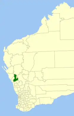 Locatie van Shire of Mullewa in West-Australië | |||
| Situering | |||
| Staat | West-Australië | ||
| Hoofdplaats | Mullewa | ||
| Coördinaten | 28°32'13"ZB, 115°30'43"OL | ||
| Algemene informatie | |||
| Oppervlakte | 10.827,2 km² | ||
| Inwoners | 715 (2011)[1] | ||
| |||
Shire of Mullewa was een Local Government Area (LGA) in de regio Mid West in West-Australië. Shire of Mullewa telde 950 inwoners. De hoofdplaats was Mullewa.
Geschiedenis
Op 11 augustus 1911 werd het Mullewa Road District opgericht. Het veranderde op 23 juni 1961 van naam en werd de Shire of Mullewa. Op 12 mei 2011 werd het met de City of Geraldton-Greenough samengevoegd tot de City of Greater Geraldton.[2]
Plaatsen, dorpen en lokaliteiten
Bevolkingsaantal
| Jaar | bevolkingsaantal |
|---|---|
| 1921 | 816 |
| 1933 | 1.622 |
| 1947 | 1.325 |
| 1954 | 1.657 |
| 1961 | 1.627 |
| 1966 | 1.825 |
| 1971 | 1.849 |
| 1976 | 1.859 |
| 1981 | 1.648 |
| 1986 | 1.455 |
| 1991 | 1.390 |
| 1996 | 1.176 |
| 2001 | 1.118 |
| 2006 | 982 |
| 2011 | 715 |
Bronnen, noten en/of referenties
- Dit artikel of een eerdere versie ervan is een (gedeeltelijke) vertaling van het artikel Shire of Mullewa op de Engelstalige Wikipedia, dat onder de licentie Creative Commons Naamsvermelding/Gelijk delen valt. Zie de bewerkingsgeschiedenis aldaar.
- ↑ (en) Australian Bureau of Statistics, 2011 Census QuickStats Mullewa (S) Code LGA56020 (LGA) (3 januari 2020). Gearchiveerd op 3 januari 2020. Geraadpleegd op 3 januari 2020.
- ↑
 (en) Municipality Boundary Amendments Register Release 4.0 7-12. Western Australian Government (31 juli 2011). Geraadpleegd op 3 januari 2020.
Geplaatst op:
03-09-2008
03-09-2008
Dit is een beginnetje over landen & volken. U wordt uitgenodigd om op bewerken te klikken om uw kennis aan dit artikel toe te voegen.