Shire of Dumbleyung
| Local Government Area van Australië | |||
|---|---|---|---|
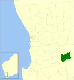 Locatie van Shire of Dumbleyung in West-Australië | |||
| Situering | |||
| Staat | West-Australië | ||
| Hoofdplaats | Dumbleyung | ||
| Coördinaten | 33°18'54"ZB, 117°44'17"OL | ||
| Algemene informatie | |||
| Oppervlakte | 2.540,1 km² | ||
| Inwoners | 681 (2021)[1] | ||
| Overig | |||
| Wards | 4 | ||
| Website | (en) Shire of Dumbleyung | ||
| |||
Shire of Dumbleyung is een Local Government Area (LGA) in de regio Wheatbelt in West-Australië. Shire of Dumbleyung telde 681 inwoners in 2021. De hoofdplaats is Dumbleyung.
Geschiedenis
Het Dumbleyung Road District werd op 1 oktober 1901 opgericht. Ten gevolge van de Local Government Act van 1960 veranderde het district op 23 juni 1961 van naam en werd de Shire of Dumbleyung.[2]
Beschrijving
Shire of Dumbleyung is een landbouwdistrict in de regio Wheatbelt in West-Australië. Het is ongeveer 2.500 km² groot en telde 681 inwoners in 2021.
Plaatsen, dorpen en lokaliteiten
- Dumbleyung
- Dongolocking
- Kukerin
- Merilup
- Moulyinning
- Nippering
- Tarin Rock
Bevolkingsaantal
| Jaar | Bevolkingsaantal |
|---|---|
| 1911 | 929 |
| 1921 | 1.689 |
| 1933 | 1.610 |
| 1947 | 1.246 |
| 1954 | 1.493 |
| 1961 | 1.444 |
| 1966 | 1.458 |
| 1971 | 1.221 |
| 1976 | 1.038 |
| 1981 | 1.009 |
| 1986 | 1.021 |
| 1991 | 856 |
| 1996 | 834 |
| 2001 | 701 |
| 2006 | 632 |
| 2016 | 671 |
| 2021 | 681 |
Bronnen, noten en/of referenties
- Dit artikel of een eerdere versie ervan is een (gedeeltelijke) vertaling van het artikel Shire of Dumbleyung op de Engelstalige Wikipedia, dat onder de licentie Creative Commons Naamsvermelding/Gelijk delen valt. Zie de bewerkingsgeschiedenis aldaar.
- ↑ (en) 2021 Census Dumbleyung (LGA). ABS. Geraadpleegd op 24 juli 2022.
- ↑
 (en) Municipality Boundary Amendments Register Release 4.0 7. Western Australian Government (31 juli 2011). Geraadpleegd op 15 februari 2020.
Geplaatst op:
03-09-2008
03-09-2008
Dit is een beginnetje over landen & volken. U wordt uitgenodigd om op bewerken te klikken om uw kennis aan dit artikel toe te voegen.