Lafayette County (Missouri)
| County in de Verenigde Staten | |||
|---|---|---|---|
 | |||
| Situering | |||
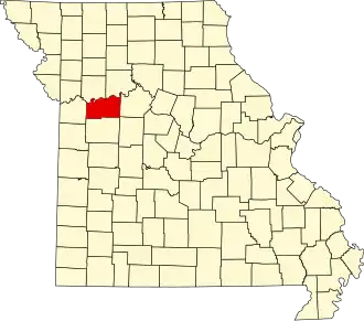
| Staat | Missouri | ||
| Coördinaten | 39°3'36"NB, 93°46'48"WL | ||
| Algemeen | |||
| Oppervlakte | 1.655 km² | ||
| - land | 1.630 km² | ||
| - water | 25 km² | ||
| Inwoners (2000) |
32.960 (20 inw./km²) | ||
| Overig | |||
| Zetel | Lexington | ||
| FIPS-code | 29107 | ||
| Opgericht | 1820 | ||
| Website | www | ||
| Foto('s) | |||
 | |||
 Bevolkingspiramide Lafayette County | |||
| Statistieken volkstelling Lafayette County | |||
| |||
Lafayette County is een county in de Amerikaanse staat Missouri.
De county heeft een landoppervlakte van 1.630 km² en telt 32.960 inwoners (volkstelling 2000). De hoofdplaats is Lexington.
Bevolkingsontwikkeling
| Jaar | Inwoners | % ± | |
|---|---|---|---|
| 1900 | 31.679 | — | |
| 1910 | 30.154 | −4,8% | |
| 1920 | 30.006 | −0,5% | |
| 1930 | 29.259 | −2,5% | |
| 1940 | 27.856 | −4,8% | |
| 1950 | 25.272 | −9,3% | |
| 1960 | 25.274 | 0,0% | |
| 1970 | 26.626 | 5,3% | |
| 1980 | 29.925 | 12,4% | |
| 1990 | 31.107 | 3,9% | |
| 2000 | 32.960 | 6,0% | |
| Bron: (en) Historical Decennial Census Population | |||