Aporá
| Gemeente in Brazilië | |||
|---|---|---|---|
  | |||
 | |||
| Situering | |||
| Regio | Noordoost | ||
| Staat | Bahia | ||
| Mesoregio | Nordeste Baiano | ||
| Microregio | Alagoinhas | ||
| Coördinaten | 11° 40′ ZB, 38° 5′ WL | ||
| Algemeen | |||
| Oppervlakte | 572,226 km² | ||
| Inwoners (2009) |
18.738 (30,6 inw./km²) | ||
| Hoogte | 186 m | ||
| Gemeentenummer | 2901908 | ||
| Politiek | |||
| Burgemeester | Ivonei Raimundo dos Santos | ||
| Gesticht | 14 augustus 1958 | ||
| Overig | |||
| Tijdzone | UTC−3 | ||
| HDI | 0,604 | ||
| Website | apora.ba.gov.br | ||
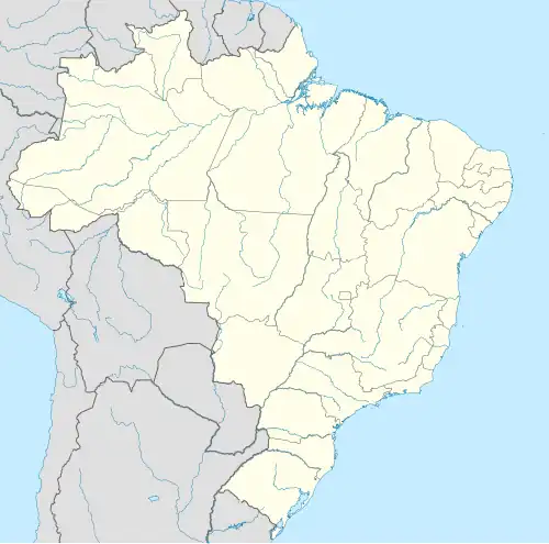
| Detailkaart | |||
 | |||
| Locatie van Aporá in de staat Bahia | |||
| Foto's | |||
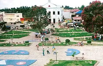 | |||
| Plein met Katholieke kerk Nossa Senhora da Conceição in het centrum van Aporá | |||
| |||
Aporá is een gemeente in de Braziliaanse deelstaat Bahia. De gemeente telt 18.738 inwoners (schatting 2009).
Bronnen, noten en/of referenties
Zie de categorie Aporá van Wikimedia Commons voor mediabestanden over dit onderwerp.